Bavaria, filtered

Destinations

Structured data behind every card: access from Munich, cost, season, crowds and my own scores.

Trip type
Region

6 results

Guides

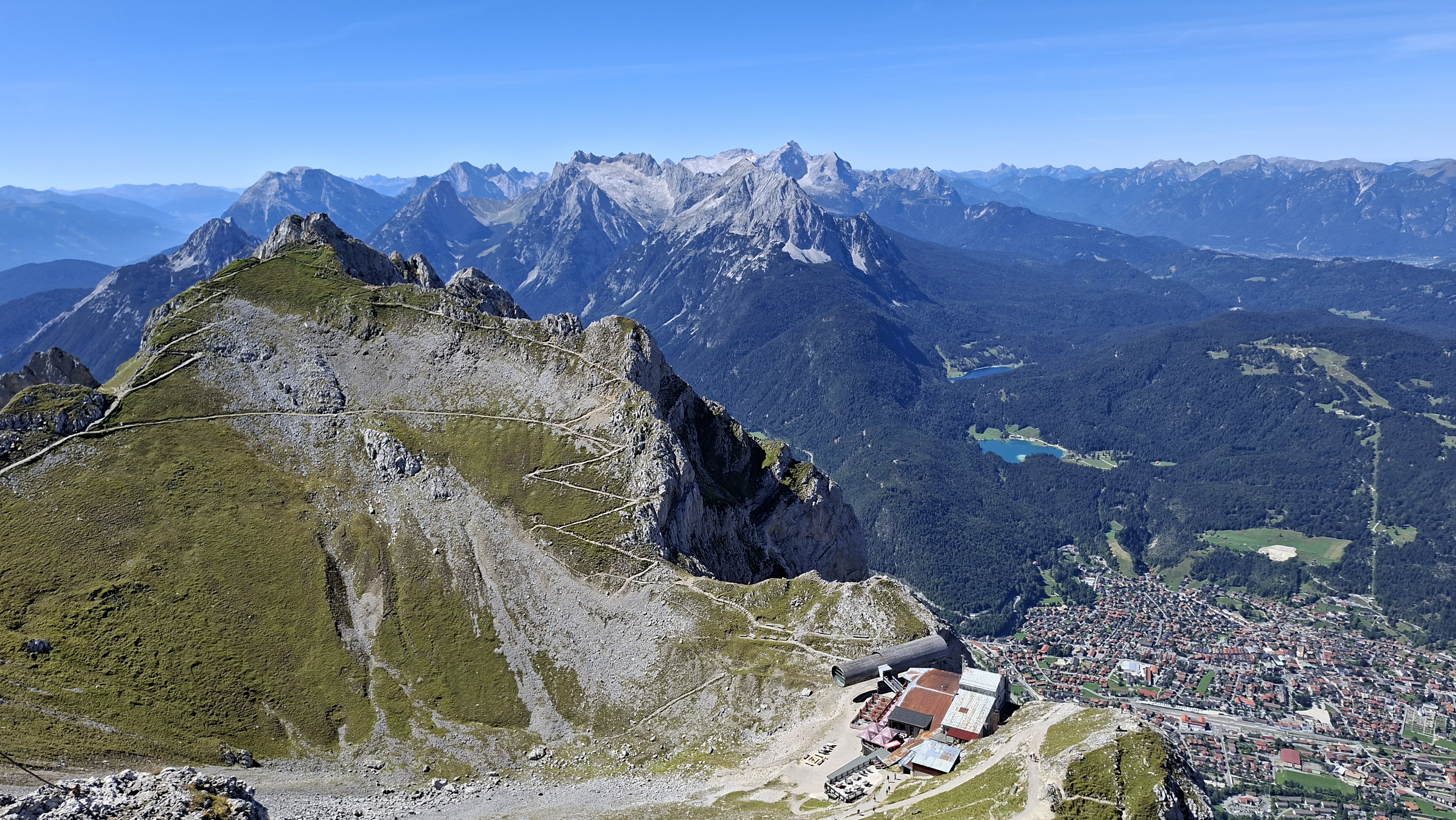
Panoramic view from the Karwendelbahn summit down to Mittenwald, with the Lautersee and Ferchensee lakes and the Wetterstein range in the background.
Bavaria WanderlustMittenwald, Karwendel

Karwendelbahn: Germany's Second-Highest Cable Car, Its Own Brewery, and a Trail Full of Sheep

The first time I rode up the Karwendelbahn, fog swallowed the summit whole — I could hear the wind and not much else. This time I waited for a clear forecast instead, and it turned out patience was the only thing I'd been missing. From the top terrace, the Wetterstein range lines up on one side and the Austrian Karwendel on the other, and somewhere in between, a herd of sheep has the best view in Bavaria and doesn't care who knows it.

About 2 h by train from München Hbf to Mittenwaldhigh crowdsHaki 8.3
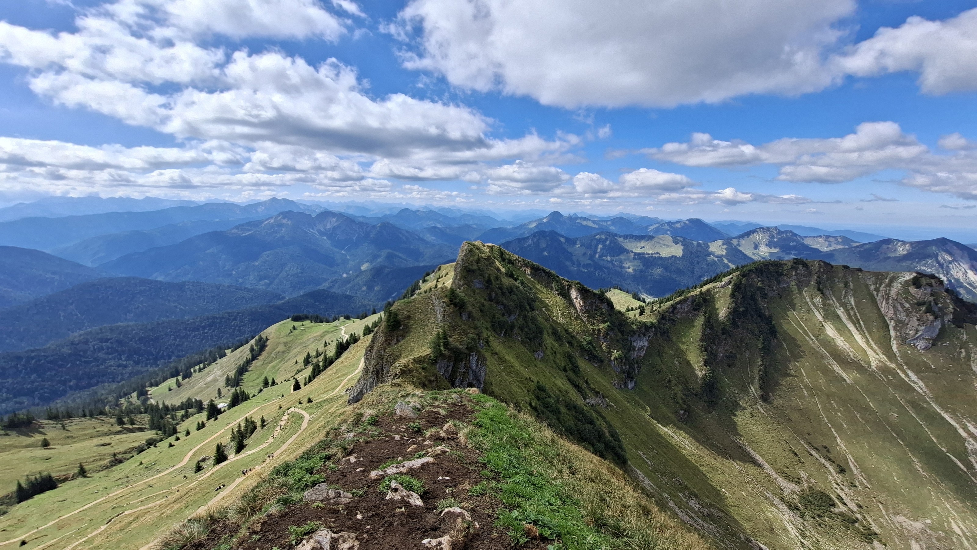
Panoramic view along the narrow Rotwand summit ridge, with hikers on the trail and layered mountain ranges in the background.
Bavaria WanderlustSpitzingsee, Mangfallgebirge

Rotwand from Spitzingsee: Up on Foot, Down by Cable Car, and a Käsespätzle in Between

The sign at the trailhead doesn't waste words: alpine experience, sure-footedness, and a head for heights required. I read it, shrugged, and kept walking. By the time I was holding a steel cable over slick rock below Taubenstein, with families ahead of me deciding whether to turn back, I understood why the German Alpine Club bothers putting signs like that up at all. The ridge past it, all the way to Rotwand's 1,884 m summit, is the reason to come. The Käsespätzle and the cable car down are the reason it doesn't hurt to stay a while first.

About 1 h 45 min by train and bus from München Hbfmedium crowdsHaki 8.3
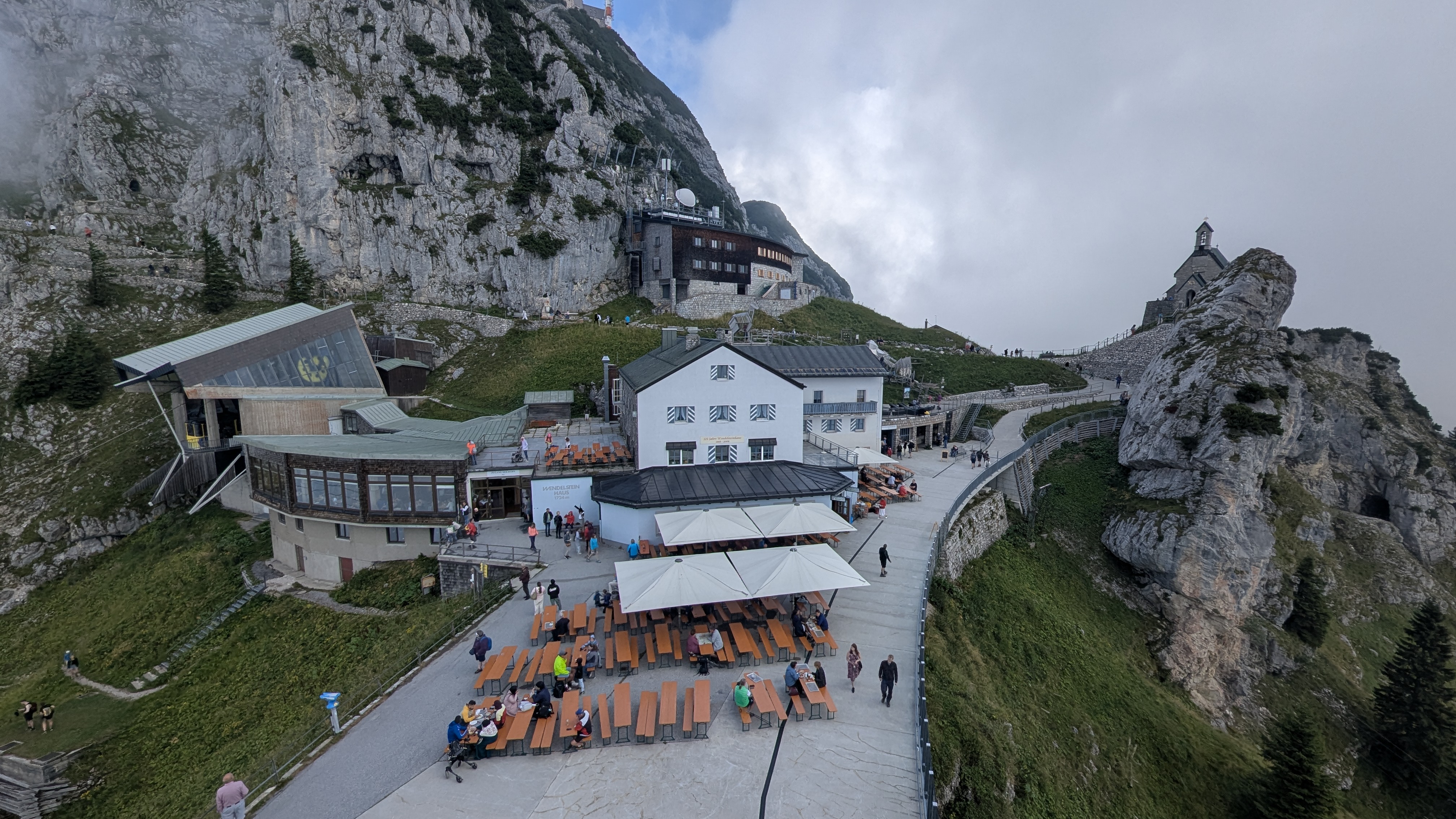
Wendelstein summit complex in the Bavarian Alps, with the Wendelstein-Haus restaurant terrace, cable car station, and the summit chapel perched on the rock spur.
Bavaria WanderlustOsterhofen, Mangfallgebirge

Wendelstein: A Real Alpine Hike, One Train Ride from Munich

I climbed Wendelstein expecting a quiet alpine trail and found a mountain with its own church, cave, restaurant terrace, and university observatory waiting at the top, plus a cable car and a rack railway (opened in 1912, the oldest still running in Bavaria) in case my legs gave out first. They didn't, but it was close: the official signs say 3.5 hours up, and I did it in 2.5.

About 1.5 h by train (BRB, München–Bayrischzell line) to Osterhofen, or about 1 h to Brannenburg (München–Rosenheim–Kufstein line) for the rack-railway sidemedium crowdsHaki 8.3
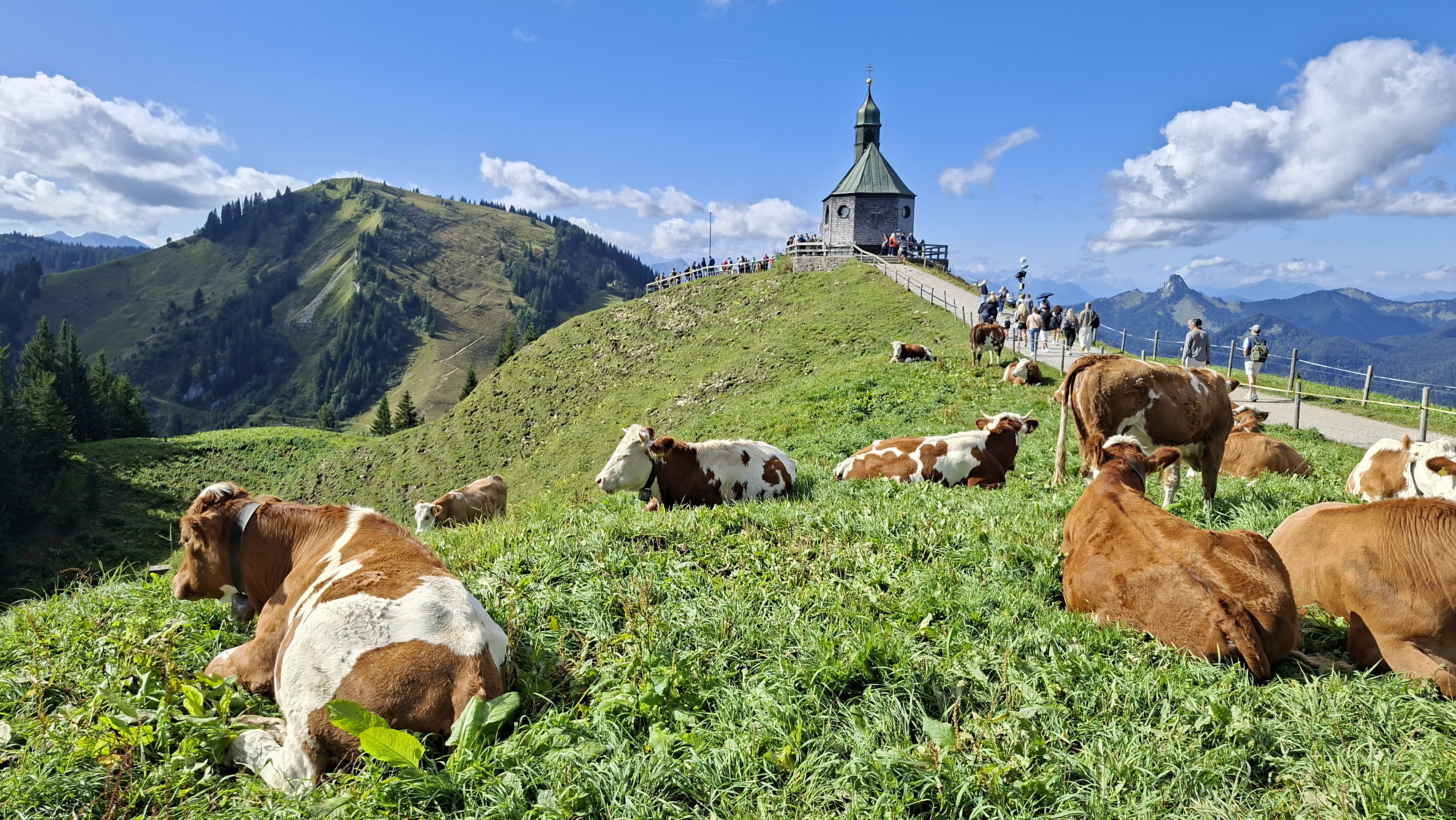
The Wallbergkirchl chapel with cows grazing on the ridge above Tegernsee.
Bavaria WanderlustRottach-Egern, Mangfallgebirge

Setzberg via Wallberg

I set out for Risserkogel. By the time I reached the top of the Wallbergbahn it was already clear the clock wouldn't allow it, so I took the shorter ridge to Setzberg instead — three hours at the top, more than 25 paragliders in the air at once, and a chapel with its own herd of cows on the way.

About 1h05 by direct BOB regional train (RB57) to Tegernsee, then bus 356 (stand 1) to the Wallbergbahn valley stationmedium crowdsHaki 8.3
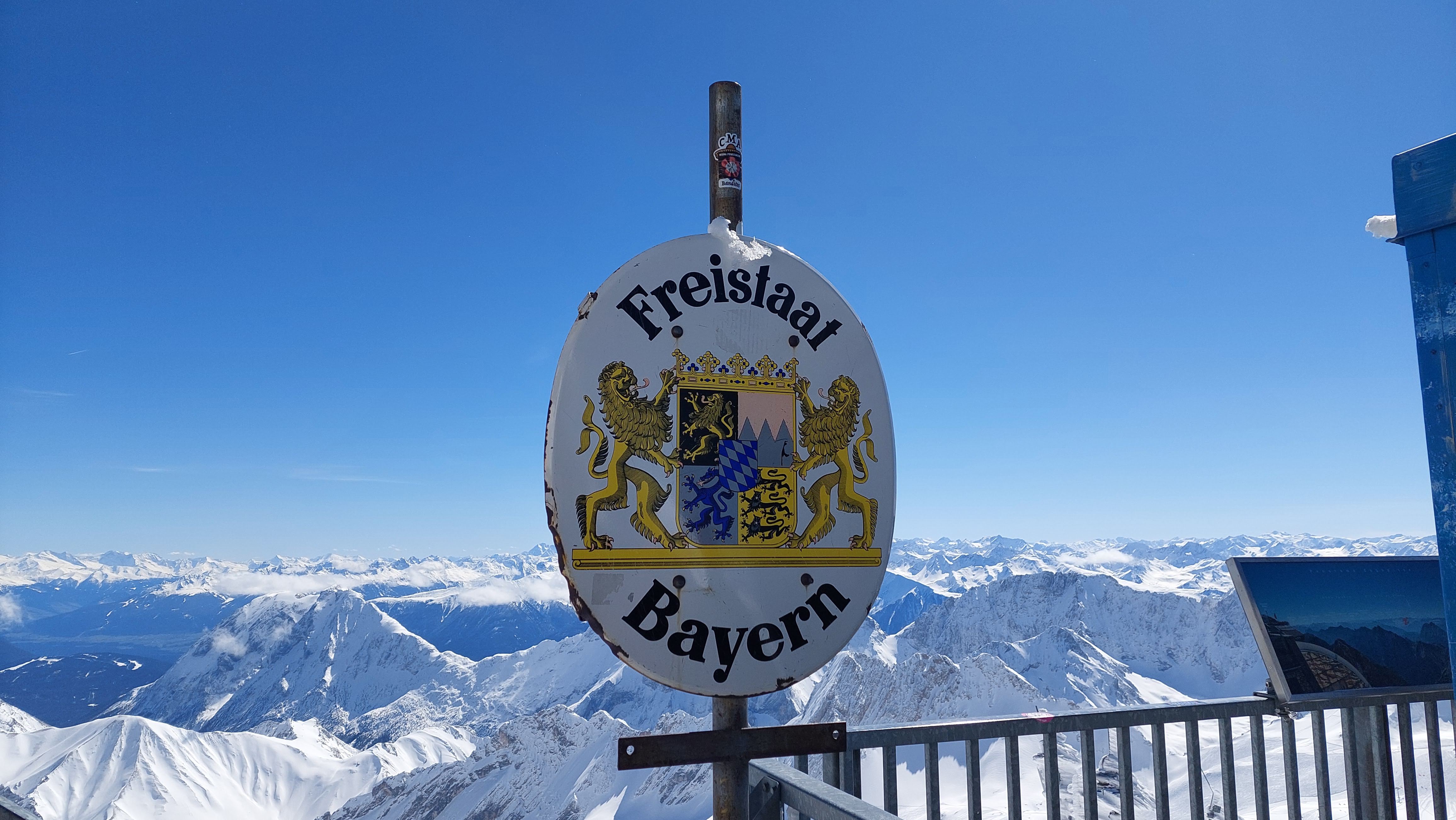
An oval sign reading 'Freistaat Bayern' mounted on a railing at the Zugspitze summit, with a panorama of snow-covered mountains behind
Bavaria WanderlustGrainau / Garmisch-Partenkirchen

Zugspitze: How I Got to the Top of Germany Without Really Hiking at All

Two visits, six months apart — one buried in March snow, one packed with September crowds. Here's how to get from Munich to Germany's highest point by train and cable car, why I never made it to the actual summit cross, and why you should build in more time than you think you need.

1 h 30 min by train to Garmisch, then the cogwheel train (about 1 h) or the cable car up the mountainhigh crowdsHaki 8.5